isles of mud (Landscape Urbanism)
Island Plan at 1:2500 scale

Glowing Urban Model
Featured on SuperArchitects and NextTopArchitects
Under the Instruction of Bradley Cantrell | Spring 2015
Jamaica Bay, New York, NY
In collaboration with Matthew Gindlesperger, BArch '10, MLA '16
—
In the wake of Hurricane Sandy’s devastating impact on Jamaica Bay in 2012, public discourse has shifted toward the urgent need for infrastructure capable of mitigating future storm surges. Coastal resilience is now a primary concern for habitation along the water’s edge, particularly as 123.3 million people globally reside in coastal cities. The threats of inundation and rising sea levels demand a new approach to urban form—one that is not only resilient but also responsive to a changing environment.
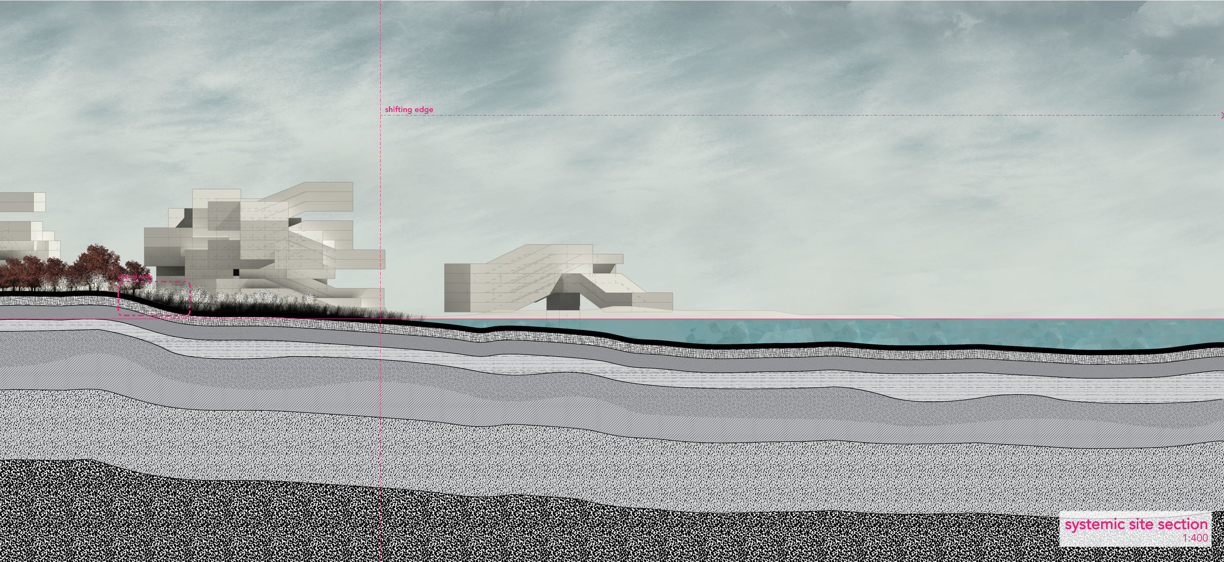
Using Jamaica Bay as a site of intervention, this proposal identifies the current three-year dredging cycle as a strategic "hinge-point" for island creation. While the U.S. Army Corps of Engineers currently transports dredge material 15 miles out to sea, this strategy suggests local deposition to expand existing islands. By utilizing a "cut and fill" process, the depth of the dredge is determined by water transit needs, with the displaced material used to build land area perpendicular to the channels. These new landmasses, reinforced by groves of barrier forests, will act as a natural armor against future surges while accommodating projected population growth.
Longitudinal Section across the proposed island design
Enlarged Sections:


Jamaica Bay island + dredge plan
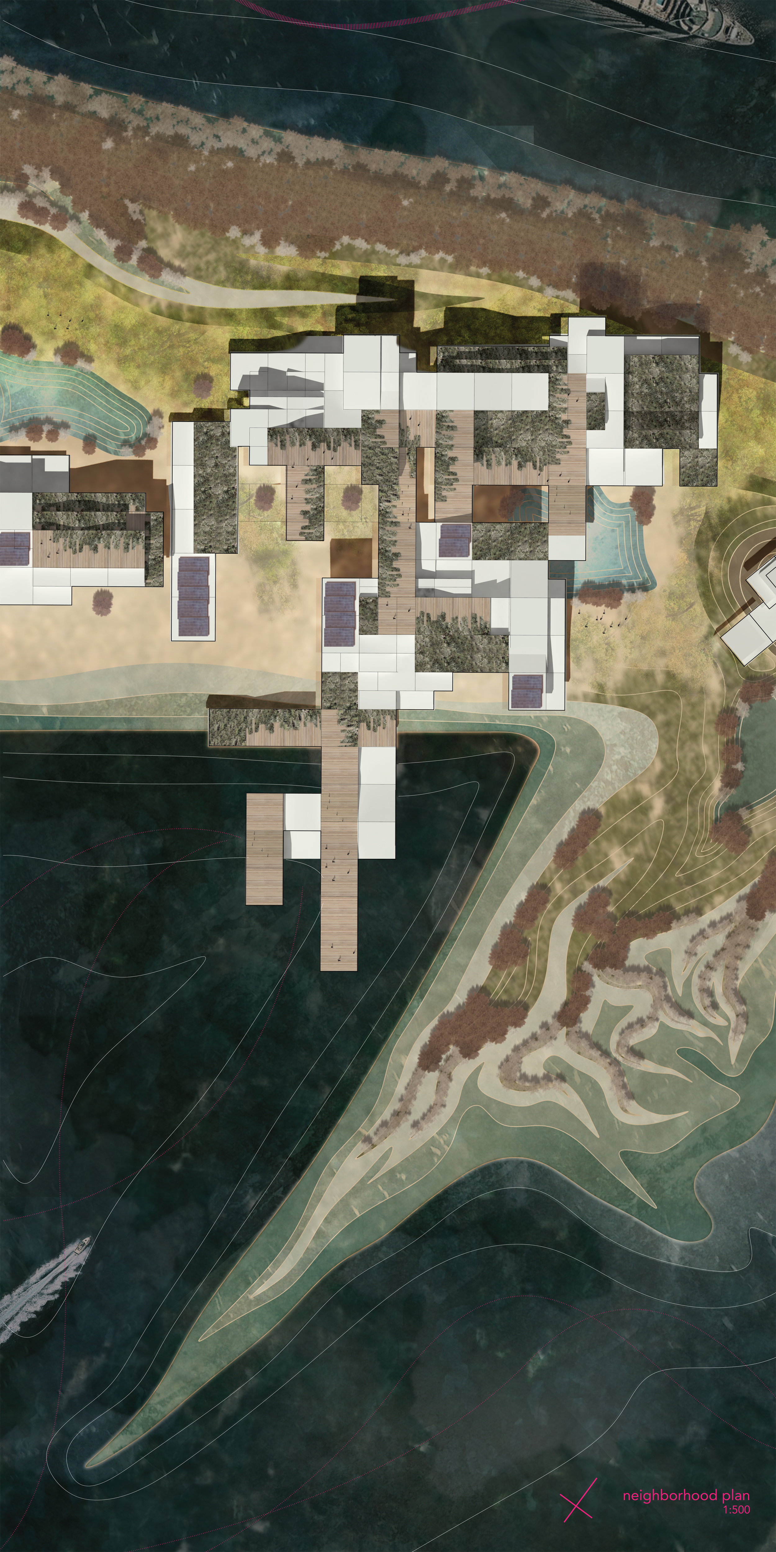
Urban/Neighborhood Plan

Aerial Perspective of a proposed island

Perspective from the Barrier Forest

Perspective from the Urban Form
Proposed Plant Species

Grading Plan (Mid Review Development/Landform)
Proposed Details:


Presentation Models:


Conceptual Diagrams + Analyses:


Mid Review Conceptual Analysis + Proposal:

Isles of Mud Final Review Presentation, as featured on the Harvard GSD webpage
Final Review Presentation:


